 |
![]()
![]()
Part 1 : Digital Cartography
Nothing fun here but a short history of the Computer-aided Cartography and Geographic Information Systems illustrated with the first commercial and non-commercial cartography and mapping softwares. The sources of information are mainly the books or articles listed in the bibliography. All the non-cited sources comes from the Wikipedia.
World Data Bank II (1977)
The CIA World Data Bank II is a collection of world map data, consisting of vector descriptions of land outlines, rivers, and political boundaries. The dataset was digitized between 1972 and 1977 by the US Department of State's Central Intelligence Agency (CIA).
GEODAT (1983)
Petroconsultants (based in Geneva, Switzerland, now IHS part of S&P Global) was a major producer of maps for the oil industry founded in Geneva in 1968. They initiated the first commercial global digital map project, GEODAT in 1980. The First data delivery was in June 1983. The project software was written in FORTRAN for a PDP-11 mini-computer and used on a DEC VAX 11/780 (3). The Geodat project drew heavily on the experience of the Harvard Laboratory for Computer Graphics and Spatial Analysis.
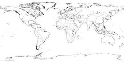
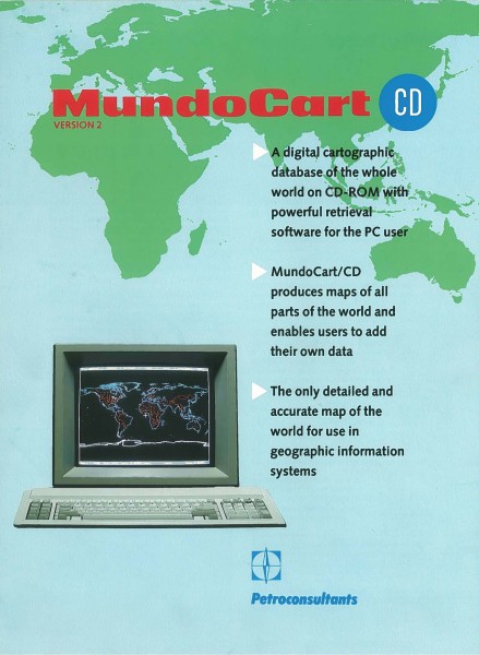
MundoCart (1985)
The Geodat project (by Petroconsultants) produced a complete digital map of the world at a scale of 1:1,000,000, MundoCart, in 1985. MundoCart provided numerous commercial and academic Geographic Information Systems (GIS) users with their first complete vector map of the world. The data was sold, along with a complete set of FORTRAN mapping software. Originally delivered as five large tapes, MundoCart was burned on CD-ROM in 1987.
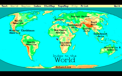
PC Globe and World Atlas (1989)
In 1989 PC Globe Inc. released PC USA and PC Globe. PC Globe is an "electronic atlas" of the world. It features continent and country maps showing world organizations, cities, elevations and other geographic features (lakes, rivers, mountains, etc.) and statistical data for all countries. World Atlas, edited by Electromap Inc. shows practicaly the same features.
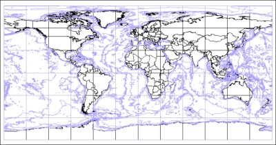
World Vector Shore Line (1991)
The World Vector Shoreline (WVS) is a digital data file at a nominal scale of 1:250,000, containing the shorelines, international boundaries and country names of the world. The World Vector Shoreline is a standard US Defense Mapping Agency (DMA) product that has been designed for use in many applications.
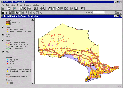
The Digital Chart of the World (1993)
The Digital Chart of the World (DCW) is an Environmental Systems Research Institute, Inc. (ESRI) product originally developed for the US Defense Mapping Agency (DMA) using DMA data.
Microsoft Encarta (1993)
Microsoft Encarta was a digital multimedia encyclopedia published by Microsoft from 1993 to 2009. In 2000, Microsoft MapPoint was embedded within Encarta, and allowed users to interact with a virtual globe that could be zoomed and rotated freely to zoom in to street level in metropolitan cities.
.
Terravision (1993)
Terravision was a 3D mapping software developed in 1993 by the German company ART+COM in Berlin using Onyx Computers developed by Silicon Graphics. Development of the project was supported by the Deutsche Post.
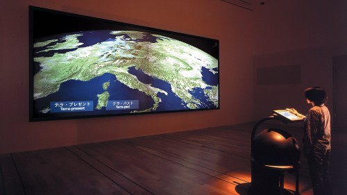
In 2006 contacts have been taken between Terravision and Google about licensing the software but ART+COM did not accept the offer. In 2001 Google Earth was relased. In 2014 Art+COM filed a lawsuit against Google for patent infrigment.
In 2017 the US Court of Appeals for the Federal Circuit invalidated Art+COM's patent.
Information about TerraVision here
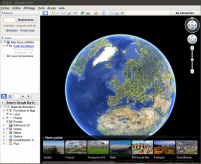
Google Earth (2001)
Google Earth is a computer program that renders a 3D representation of Earth based primarily on satellite imagery. The program maps the Earth by superimposing satellite images, aerial photography, and GIS data onto a 3D globe, allowing users to see
cities and landscapes from various angles.
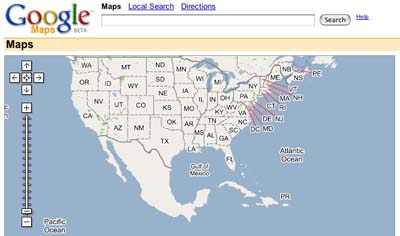
Google Maps (2004)
Google Maps first started as a C++ program designed by two Danish brothers Lars and Jens Rasmussen at the Sydney-based company Where 2 Technologies. It was first designed to be separately downloaded by users, but the company later pitched the idea for a purely Web-based product to Google management, changing the method of distribution. In October 2004, the company was acquired by Google where it transformed into the web application Google Maps.
Part 2 : Geographic Information System (GIS)
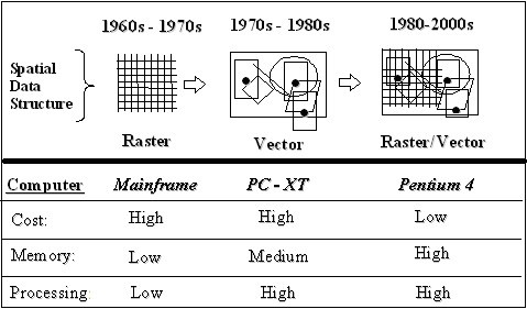
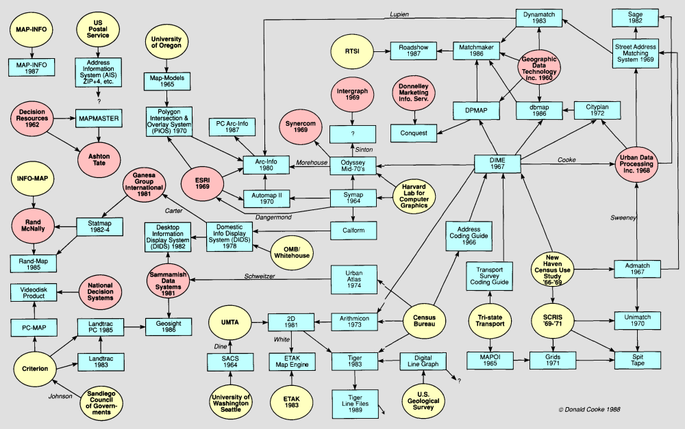
The history of the GIS start in the early 1960s in Canada (Dept. of Forestry and Rural Development) and in the USA (Harvard and Illinois universities). The site GIS TiME LiNE shows an interresting timeline of the GIS from the 1960s to the present time. Here is an short resumed chronology:
Prototype softwares
Harvard Laboratory for Computer Graphics and Spatial Analysis (1963-1991)
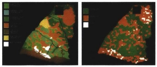
The Harvard's Laboratory initially focused on improving and selling SYMAP (Synagraphic Mapping System), a raster-based GIS wich development started in 1964, could produce conformant, proximal, and contour maps on a line printer and be used for a variety of projects, such as air pollution studies (2).
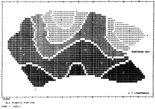
SYMAP screen capture (source:2)
Developped by the mid 70's, ODYSSEY was the first ever vector GIS and became a prototype for modern GIS software. In 1979 ODYSSEY entered the commercial market under the name LAB-LOG (1).
ODYSSEY screen capture (source:2)
First applications: one example
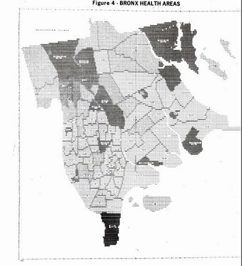
New Yorks City's Geographic Information System GIST (1970)
In 1970, New York City initiated the development of GIST (New Yorks City's Geographic Information System). The database ran on an IBM 360 system (6). The thematic map were generated using Symap and then printed.
General evolution of GIS
ESRI
The company was founded as Environmental Systems Research Institute in 1969 as a land-use consulting firm.
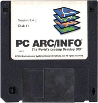
ARC/INFO
The first version of ARC/INFO was launched in 1982 on minicomputers, as ESRI claims, the very first modern GIS. The name refers to its architecture as a Geographic Information System composed of (a) geographic input, processing, and output tools ("ARC") with (b) a complementary, but separate database ("INFO"). The early releases of ARC/INFO were a set of FORTRAN programs linked accessed through a command-line interface built with the scripting language of the minicomputer (CPL on PRIMOS, DCL on VMS, etc.)
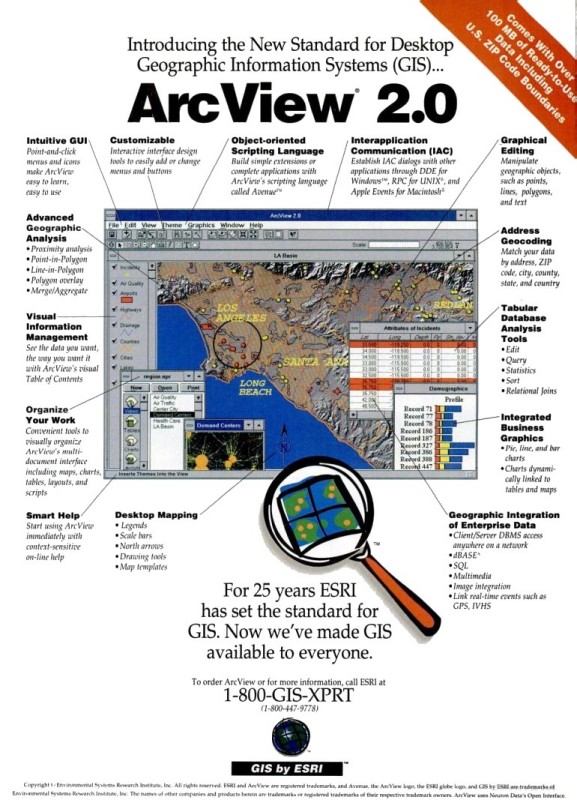
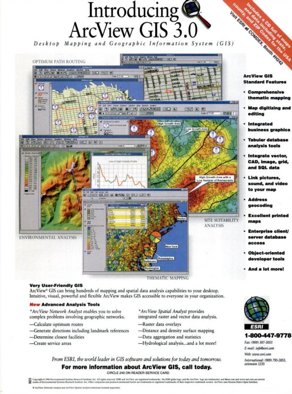
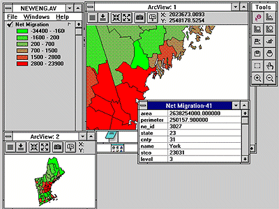
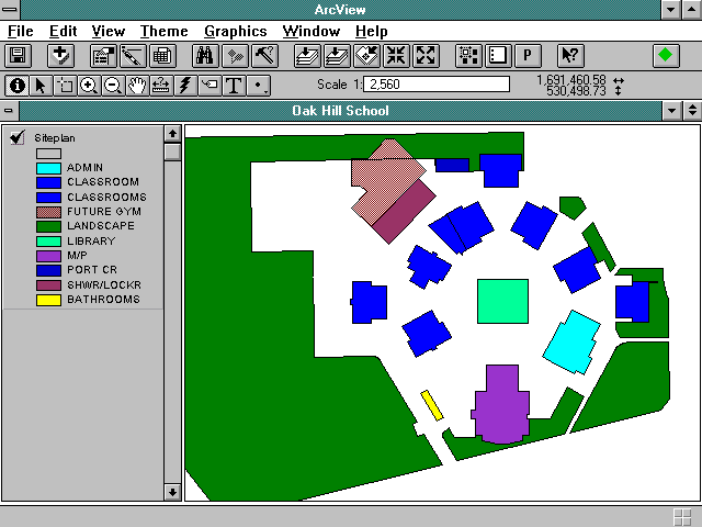
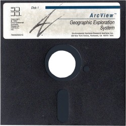
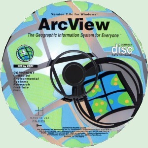
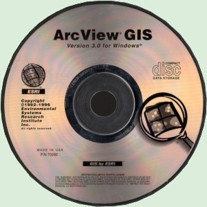
ArcView
ArcView is the entry level licensing level of ArcGIS Desktop, a geographic information system software product produced by Esri. The table below shows the major releases of Esri's products.
HP-UX, Mac OS, DG/UX
Screen captures from version 1.0 to 8.0
ArcView 1.0
ArcView 1.0 / Windows 3.1 (video capture)
ArcView 2.0
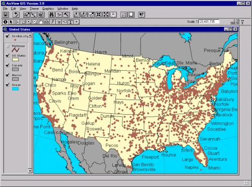
ArcView 3.0
ArcView 8.0
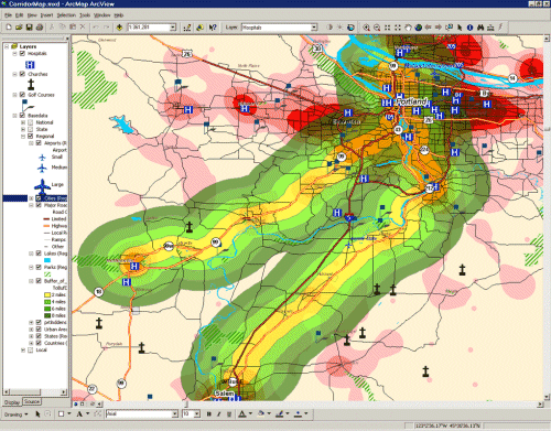
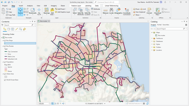
ArcGIS Pro
ESRI softwares
(epocalc collection)
Selected bibliography
| Sketchpad: A Man-Machine Graphical Communication System, 1963 |
| An introduction to the Geo-information system of the Canada Land Inventory, R. Tomlinson, 1967 |
| An Introduction to GIST - Newy York City's Geographic Information System, 5/1971 (6) |
| Computers and Cartography, Computers and Automation, 8/1972 |
| Computer-Aided Cartography, Contemporary Cartography, The Royal Geographical Society, 1977 |
| Geographic Information Systems: A review, Oregon State University, 1978 |
| Computer Generated Maps, Byte, 5/1979 |
| GEODAT: A Cartographic Data Base for Petroleum Mapping, M. Mainelli, 1982 (3) |
| A Survey of Geographic Information Systems, The America Farmland Trust, 1985 |
| The History of GIS, 1991 (4) |
| Desktop Mapping Softwares, BYTE, 1993 |
| Analytical and Computer Cartography, 1995 |
| ORNL and the Geographic Information Systems Revolution, ORNL, 1995 (5) |
| The History of Geographical Information Systems: perpectives from the pioneers, 1997 |
| The Engineering Design Revolution, 2008 |
| GRASS Roots, James Westervelt, Construction Engineering Research Laborator, 2004 |
| Charting the Unknown: How Computer Mapping at Harvard Became GIS, ESRI, 2006 (2) |
| History of the Harvard Laboratory for Computer Graphics, Université de Laval |
| Multimedia Cartography, Springer, 2007 |
| The Engineering Design Revolution, 2008 |
| Milestones in the history of thematic cartography, statistical graphics, and data visualization, 2009 |
| Stratified, Destratified, and Hybrid GIS: Organizing a Cross-Disciplinary for Design, MIT thesis, 2013 (1) |